
Adjust the drive chain before you leave
During my last ride, I noticed a strange rattle coming from the drive chain. So, before this ride, I decided to adjust the tension and lubricate it.
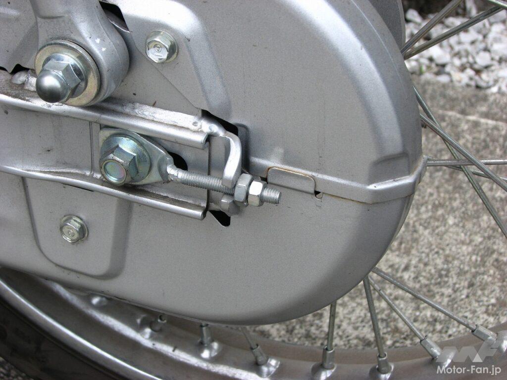
The Super Cub's drive chain is covered by a chain cover, making it difficult to see directly. However, there is an opening in part of the cover that allows for tensioning and lubrication without removing the cover. The opening is covered with a rubber cap, which can be opened to check the chain. When I checked the tension, I found that it was indeed slack.
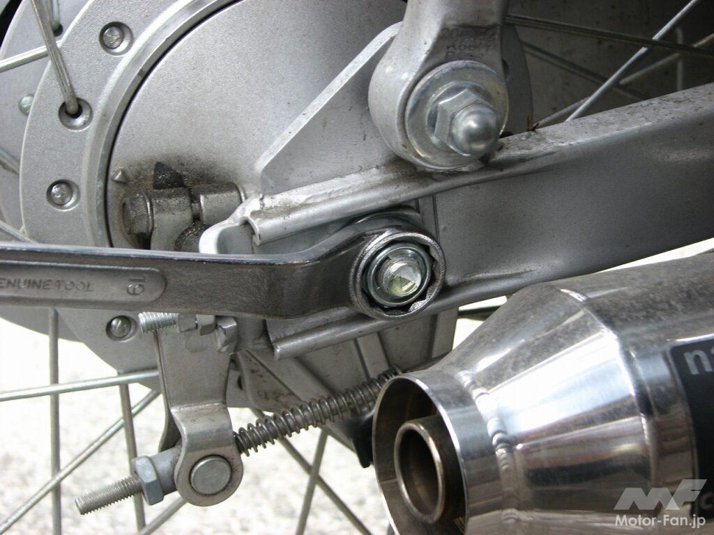
To adjust the tension, first stand the bike on the center stand, loosen the rear wheel axle shaft, and then pull it back using the chain adjuster on the rear of the swingarm to reduce the slack. The adjuster is secured with a double nut, so loosen the outer nut and then tighten the adjustment nut. Use the scale on the swingarm as a guide. Check the tension while tightening, aiming for 20-30 mm of slack. Tighten the adjuster on the right side of the bike without the chain in the same way, adjusting it so that both sides are the same. Once the adjustment is complete, secure the axle shaft and firmly tighten the adjuster's double nuts. Then, rotate the rear tire by hand while spraying chain lube onto the drive chain. Once you've finished, rotate the rear tire by hand and check that it turns smoothly, and the drive chain adjustment is complete. Incidentally, the Super Cub 110's drive chain is a 420-size non-sealed chain, so it will need to be lubricated from time to time.
Stand the vehicle on the center stand and loosen the rear wheel axle shaft.
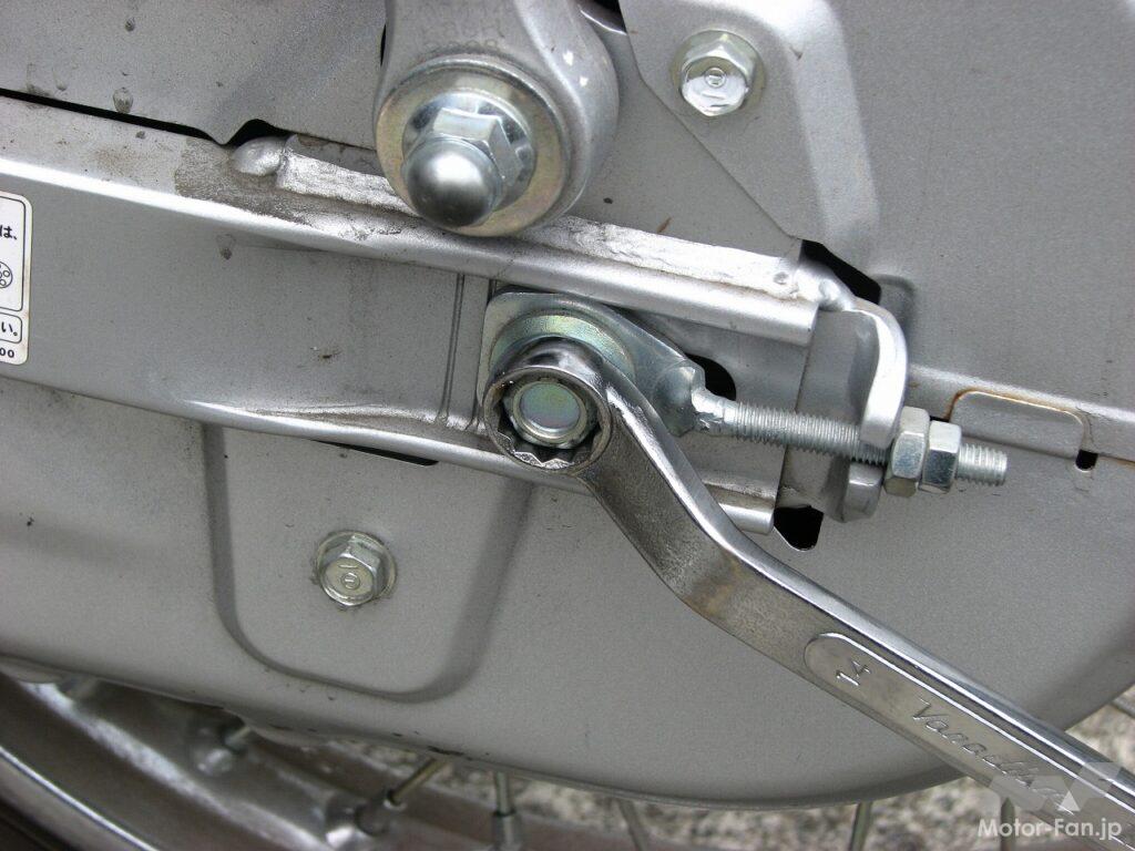
Loosen the nut on the right side of the axle shaft, but also use a wrench to loosen the bolt on the left side.
The drive chain needle is adjusted using the adjuster at the rear of the swing arm.
To check the drive chain, open the rubber plug on the chain cover.
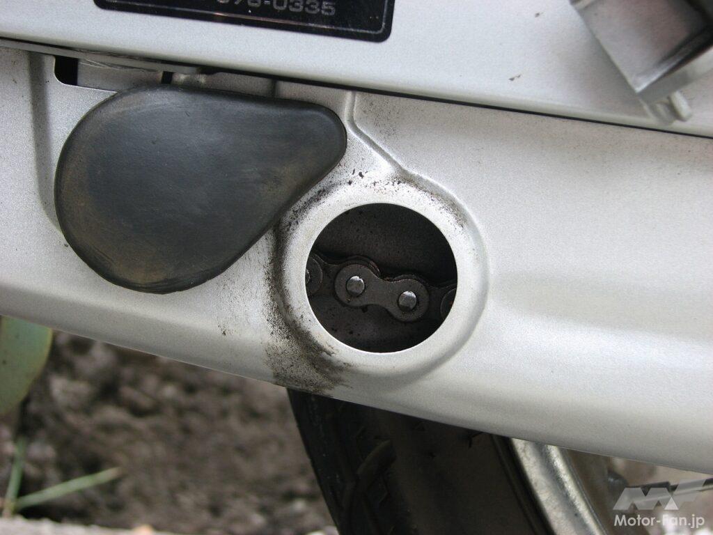
Opening the rubber stopper reveals the drive chain, allowing you to check its tension and whether it is oily.
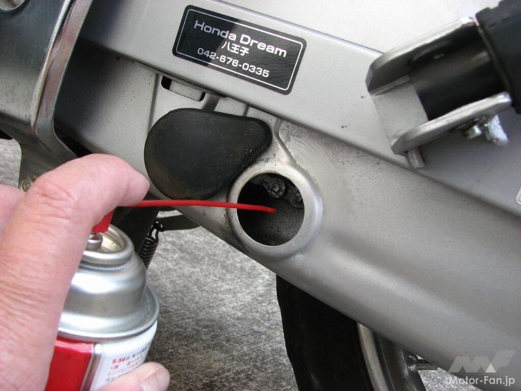
After adjusting the tension, lubricate the drive chain with chain lube.
You’ll feel excited in this hidden place that doesn’t seem like Tokyo
Located at the westernmost tip of Tokyo, Okutama is a mountainous region far removed from the urban scenery often associated with the word "Tokyo." National Route 411 (Ome-kaido), which connects Hachioji and Kofu, runs east-west through Okutama. It splits off from National Route 139, which leads to Otsuki, just beyond Lake Okutama, created by the Ogochi Dam. Furthermore, after crossing Miyama Bridge on National Route 139, you can enter the Okutama Loop Road.
Opened in 1973, the Okutama Toll Road is a 19.7-km winding road connecting Okutama Town and Hinohara Village, and has become a popular tourist route. In 1990, it was opened to traffic and renamed the Okutama Loop Road. While offering increased convenience, it has also become a popular touring route for many riders. Even today, many riders gather on the shores of Lake Okutama on weekends to enjoy the scenery and roads of Okutama.
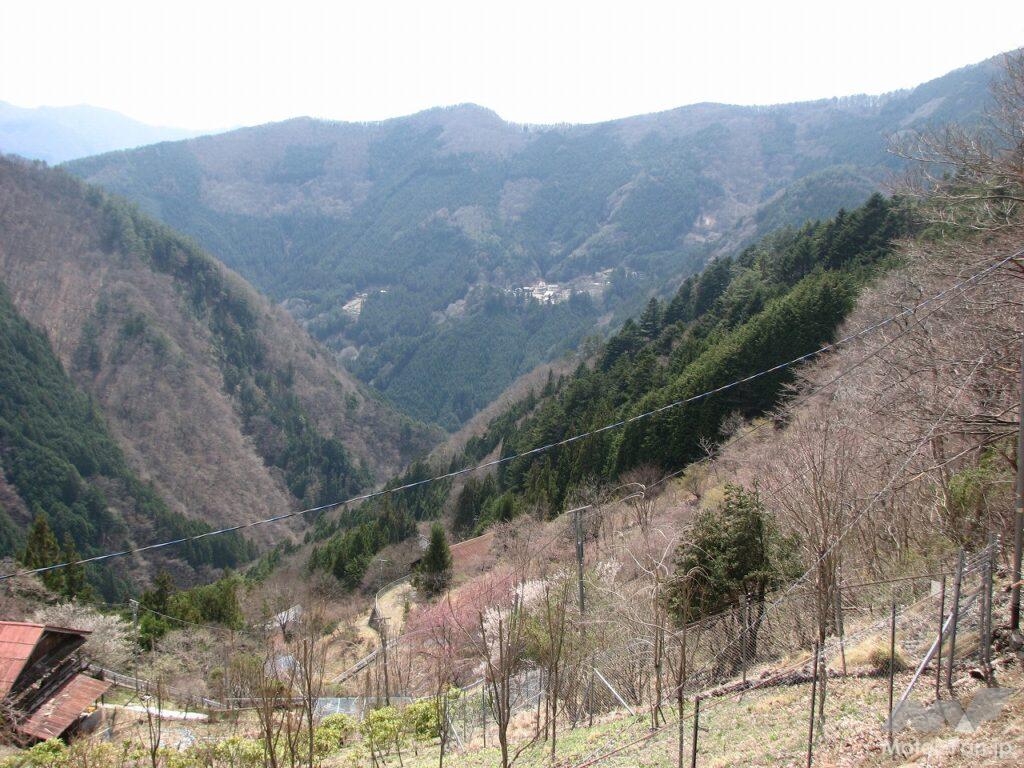
Deep in the mountains, in the deepest reaches of Okutama, where no drivers or motorbikes visit for sightseeing, is the Tomiura district. You enter the Tomiura district from the area north of the traffic light at Minetani Bridge on National Route 411. The road that follows the Minetani River narrows as you go, and after a small village, the road splits to the left. If you follow the forest road on the left, you will reach Mine village, and if you continue straight, you will reach Oku village. These two villages are Tokyo's "village in the sky." Mine
village is 650-950m above sea level, and Oku village is about 1000m above sea level, with houses clinging to the mountain slopes. This scene is truly a village in the sky, standing quietly as if
hiding .
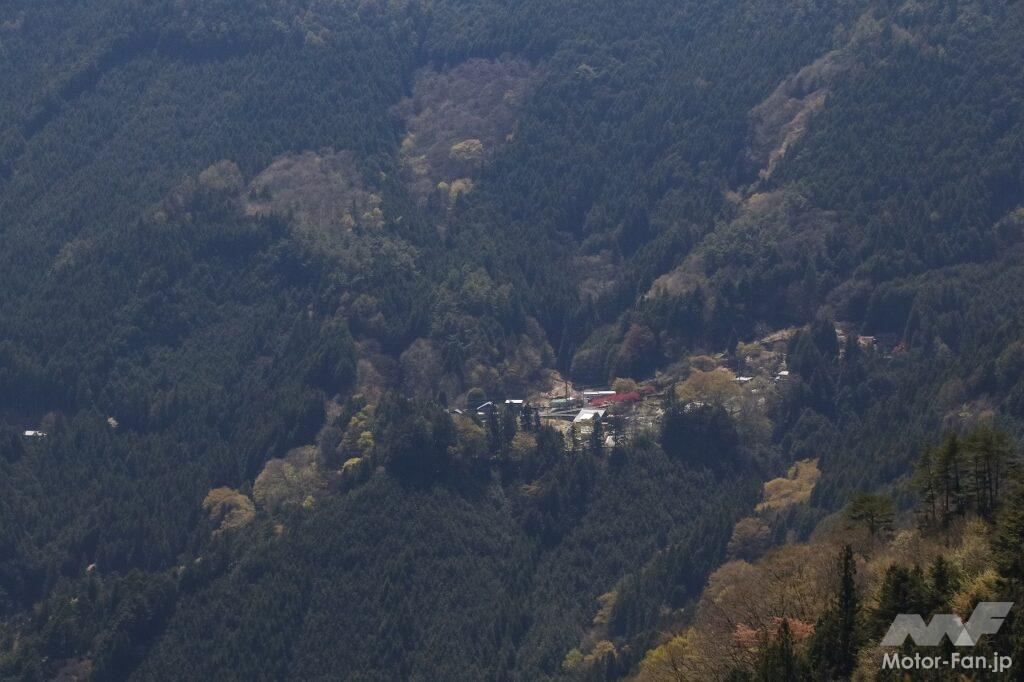
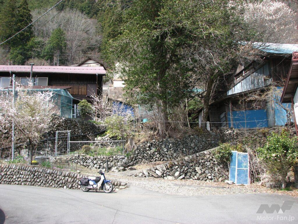
Mine village is a village in the sky, with houses scattered on the slopes of a mountain at an elevation of about 300m, between 650m and 950m above sea level. It has more residents than Oku village, and is filled with the atmosphere of a mountain village.
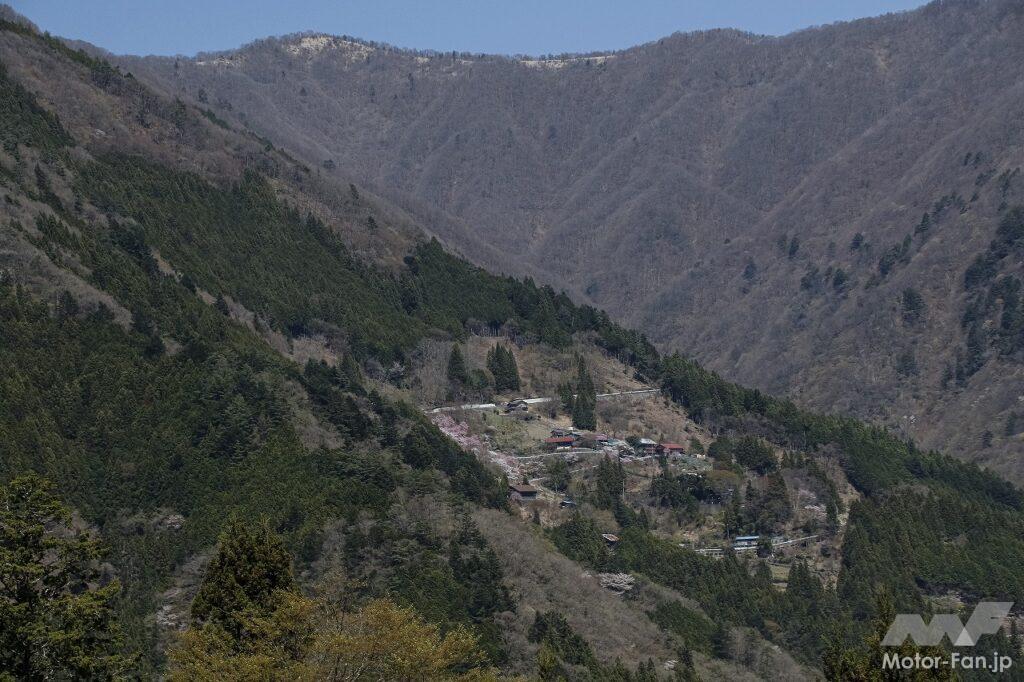
Oku village seen from Mine village. This mountain village is located in the innermost part of Tokyo, and the scenery of houses and fields scattered on the mountain slopes makes it truly a village in the sky. The highest point is 970m above sea level, and the seasons change more slowly than in the lower areas.
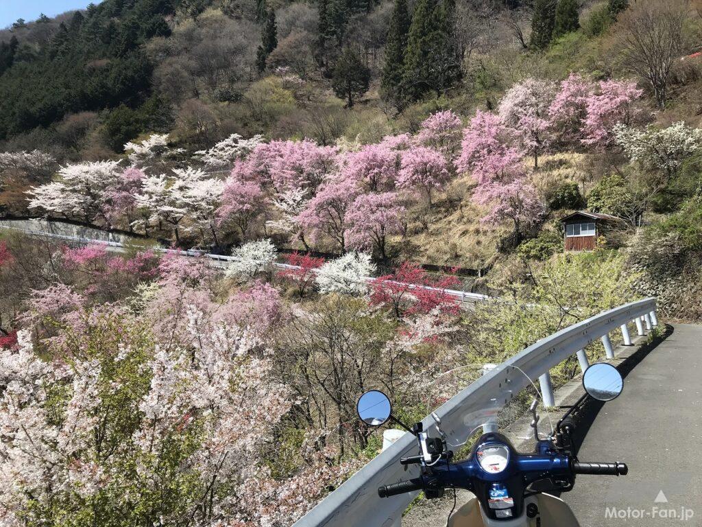
In April, when the Somei-Yoshino cherry blossoms were in full bloom, the beautiful weather lured me to Tokyo's last remaining village in the sky on my Super Cub. I headed along the Yoshino Kaido and Ome Kaido roads, but made a slight detour to see an abandoned railway line. The JR Ome Line terminates at Okutama Station, but from 1952 to 1957, the Tokyo Metropolitan Waterworks Bureau laid the Ogouchi Line, a Tokyo-exclusive line commonly known as the Mizune Freight Line, which ran between Okutama Station and Mizune Station, directly below the dam, to transport materials for the construction of the Ogouchi Dam. Nearly 70 years have passed since the line was abandoned, but remnants remain everywhere. As a train enthusiast, I often go on tours to visit remote stations and abandoned railway lines. So, this time, I decided to take a look at the abandoned Mizune Freight Line as well.
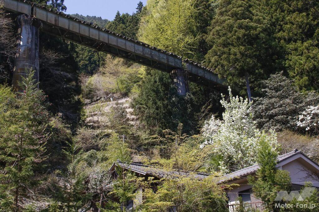
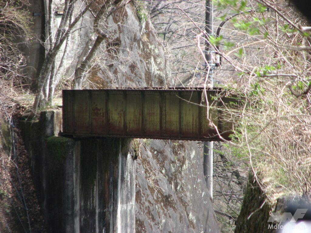
I stopped off in the Sakai district, where a few houses line the streets. Here, I could see the girder bridge of the Mizune Freight Line’s Fourth Sakai Bridge overhead. When I thought about the fact that a steam locomotive pulling freight cars was running across this bridge in 1955, the year I was born, I was deeply moved by the fact that I too have become dilapidated.
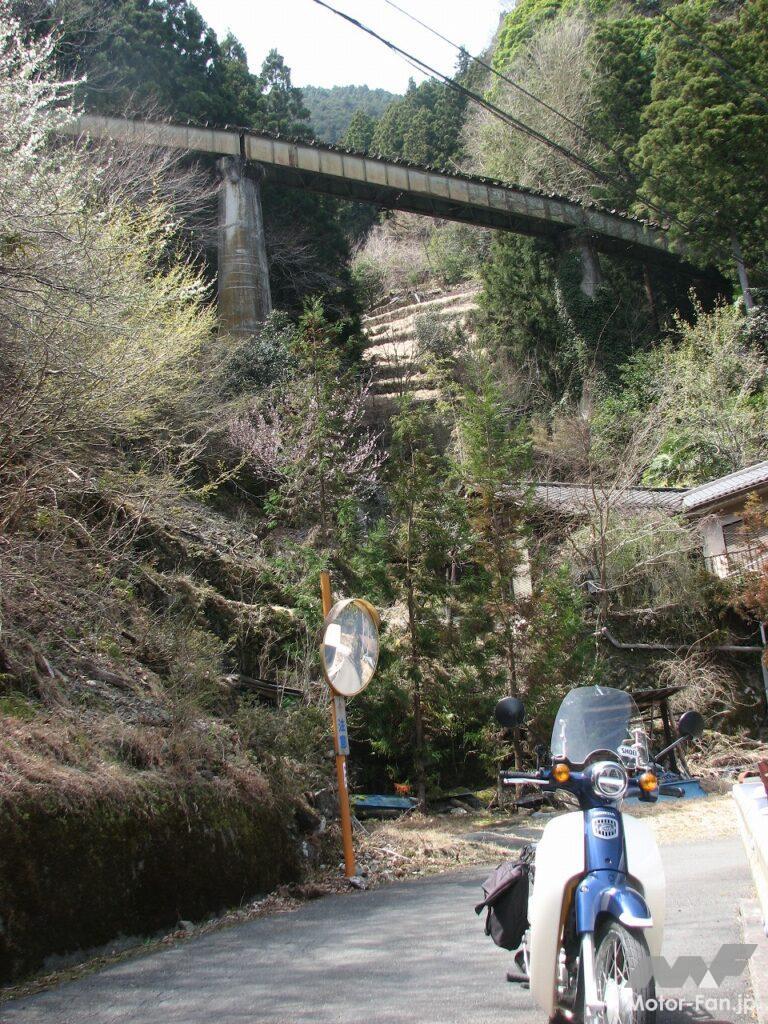
Daiichi Mizune Bridge over National Route 411
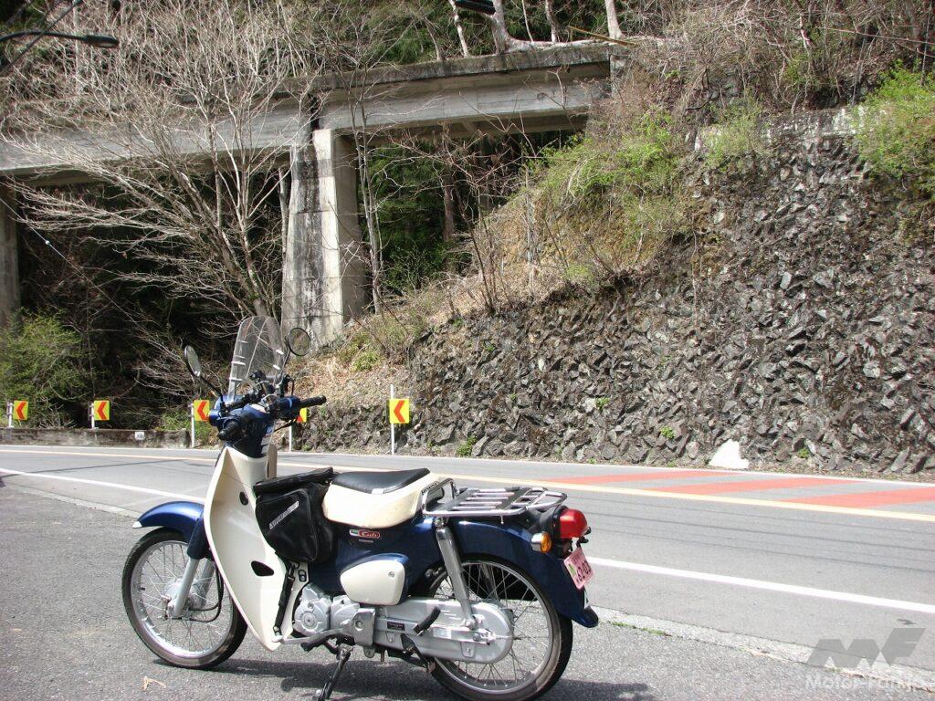
Currently, construction vehicles and other equipment are parked here, but right next to the Cub is the former Mizune Station.
The Second Mizune Bridge, the approach to Mizune Station
After about two hours of riding at my own pace, I arrived at the shore of Lake Okutama, next to Ogochi Dam. There were already several motorcycles parked in the parking lot in front of the Okutama Water and Greenery Center. I took a break to look around the center and relax, gazing at the sparkling lake.
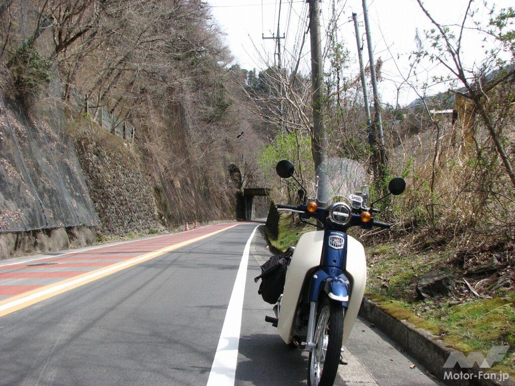
Leaving the lake by my side, I continued west on National Route 411. I turned right at the distinctive red traffic light at Minetani Bridge and left the highway. The road ascending the Minetani River eventually came across a small village. Houses, a workshop, and a single store hinted at life. About halfway through the village, a trail branched off to the left. I followed the fork on my Super Cub. The road narrowed and became steeper. Fallen rocks and dead trees were scattered about, and moss grew in the shaded areas, making for a tricky ride. After a short climb up the mountain path, the village of Mine opened up. A dozen houses and small fields gave the impression of a mountain village. Around here, we were about 650 meters above sea level. The road continued to climb, passing several houses before coming to a dead end. At its highest point, there was a single house at 950 meters above sea level. Mine Village, located on the mountain slope, had an elevation difference of about 300 meters. Tenku no Sato offered spectacular views of the Okutama mountains, but there were no people to be seen. Instead, several monkeys occupied the road as if it were their own property. Across the valley
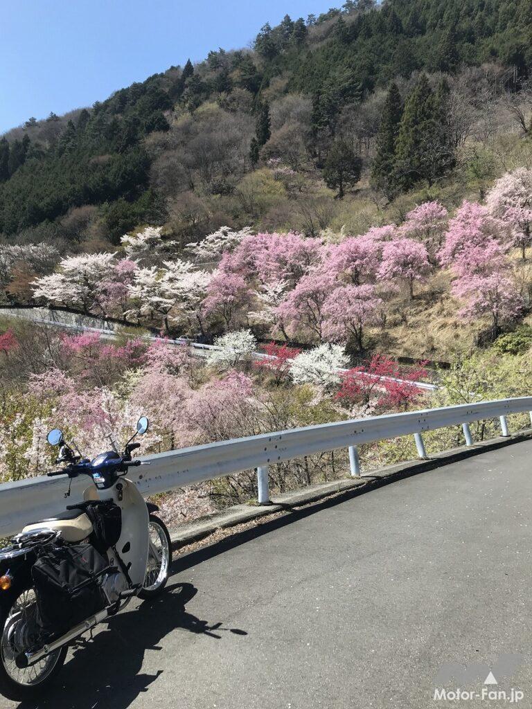
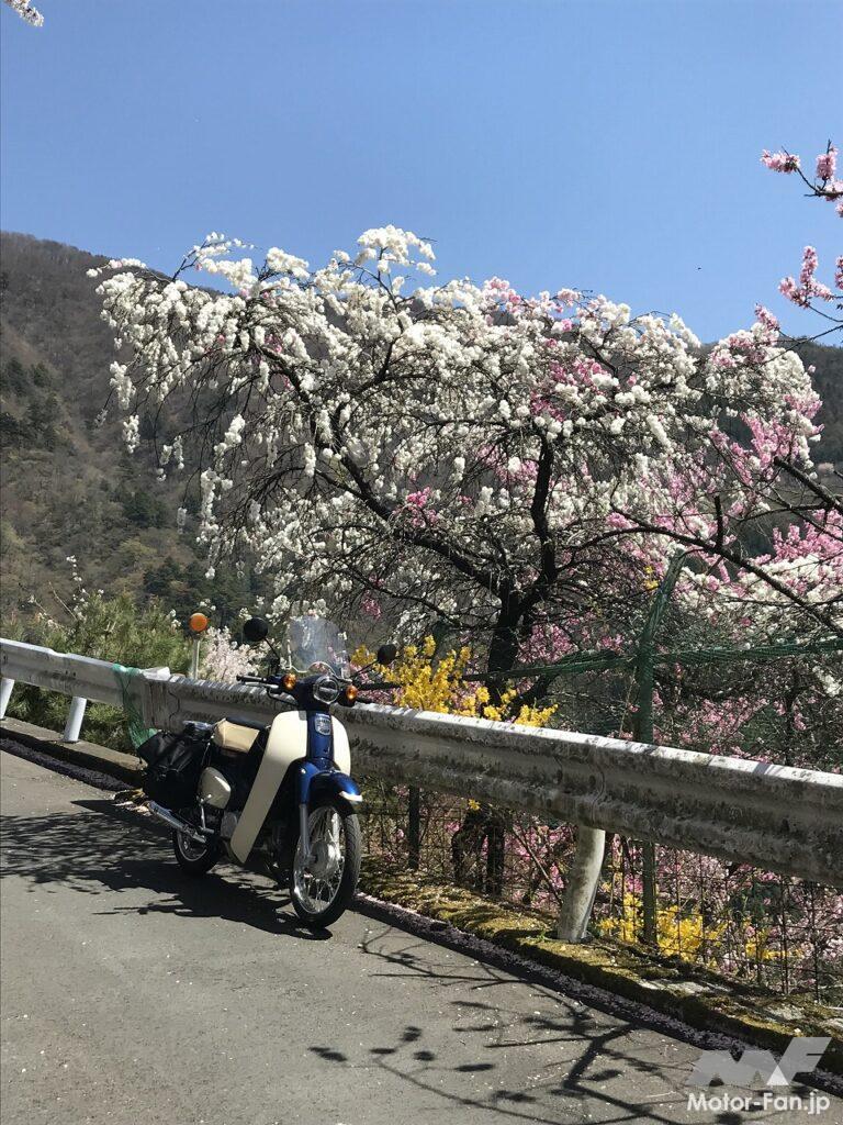
from Mine Village, we could see another village on the eastern mountainside. Oku Village was enveloped in pink flowers. We returned to the fork in the road and took the other road. The road condition was not much different from the road leading to Mine Village, making it difficult for cars to pass each other. Then, after a series of winding turns and a sudden rise in altitude, we arrived at Oku Village. Tenku no Sato, with a few houses scattered along the mountain slope, was bathed in vibrant colors of red, pink, and white. The sight of peach blossoms and cherry blossoms in full bloom, covering the slopes, was truly a paradise. The view I saw at the top of a narrow, dark mountain path took my breath away. Tenku no Sato, located in the innermost reaches of Tokyo, welcomes visitors into a paradise for a brief period in spring.
Oku Village is approximately 1,000 meters above sea level, making it the highest village in Tokyo. However, the population is declining year by year, and the village is mostly elderly. It is a so-called marginal village, and may soon become abandoned. In fact, some villages in Okutama have become abandoned. While Tokyo's population continues to grow due to centralization, mountainous areas like Okutama are experiencing depopulation, just like rural areas. The scenery of these two Tenku no Sato villages, Mine and Oku, may soon become obsolete.
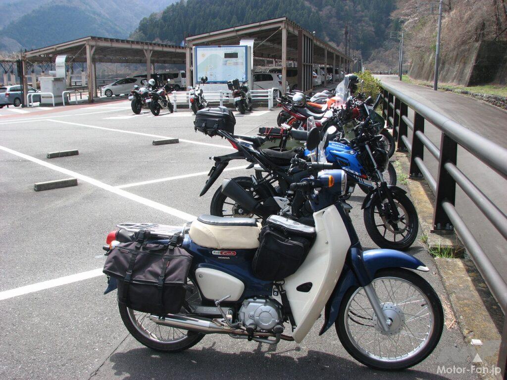
There is a large parking lot near Ogochi Dam, and there is also a space reserved for motorcycles.
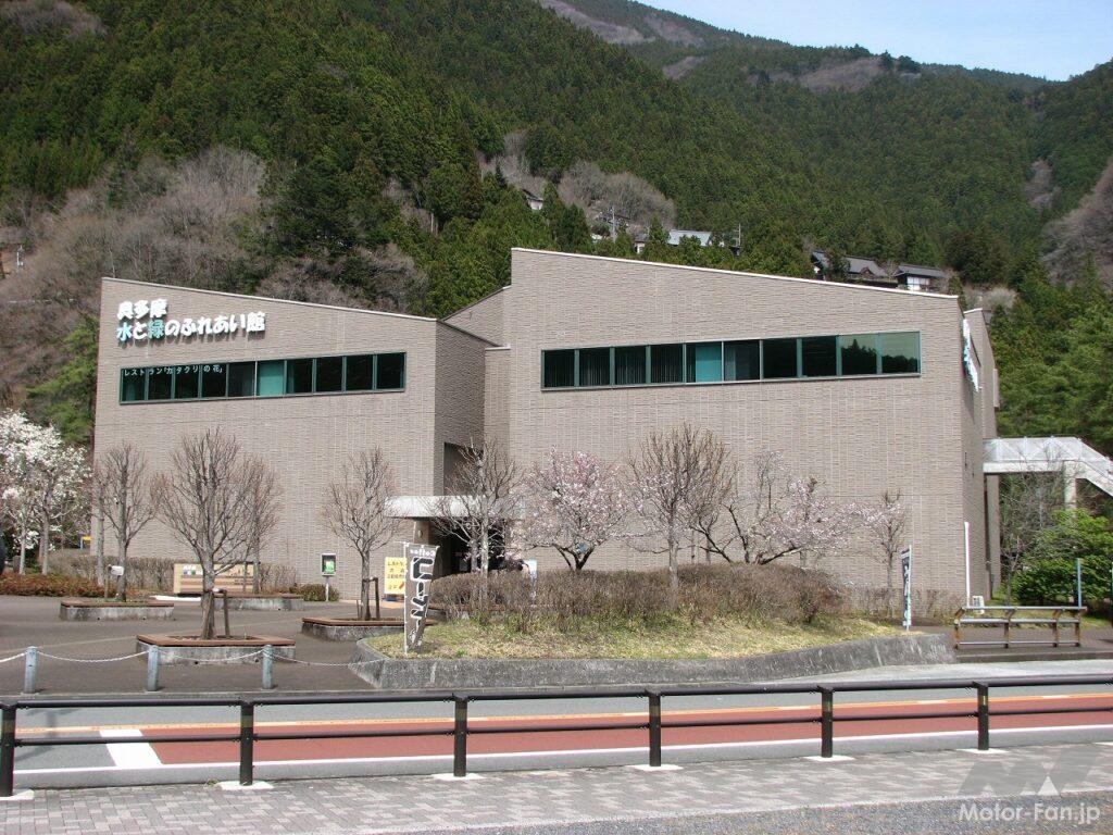
The Tokyo Metropolitan Waterworks Bureau’s PR facility, “Okutama Water and Greenery Communication Center,” also has a restaurant attached.
ADVERTISEMENT
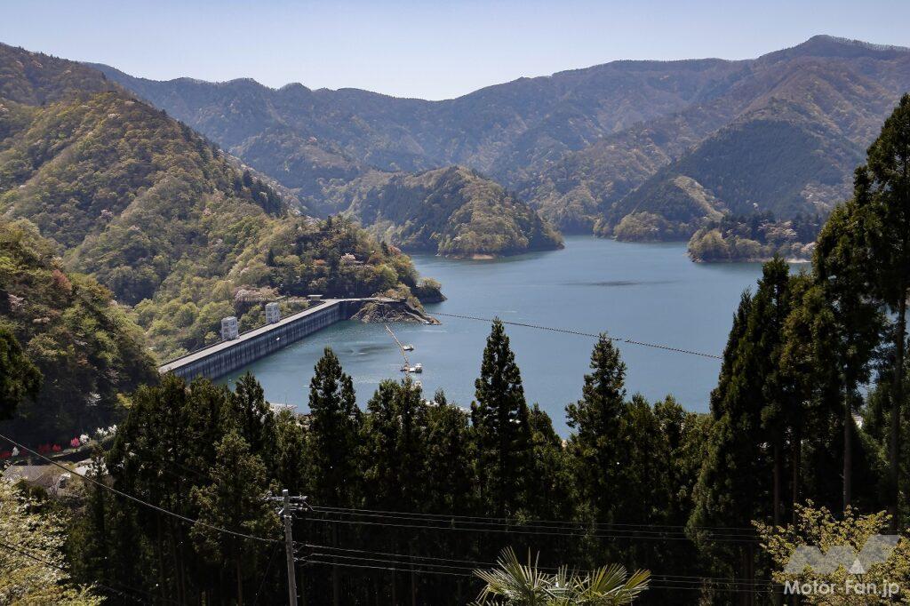
Lake Okutama was created by the Ogouchi Dam, which was completed in 1957. The Okutama Water and Greenery Museum is located near the dam. The museum displays the natural environment, the construction of the dam, and the folklore of the Ogouchi village, which was submerged by the dam. From the hilltop of Mizune village on the old Ome-kaido road, you can see the Ogouchi Dam and Lake Okutama.
Scenery of Oku Village 1
Scenery of Oku Village 2
Scenery of Oku Village 3
Scenery of Oku Village 4
Returning to Route 411 and continuing west, I went to a restaurant that I had been interested in. It was Okutama Lake Rest Center Maruitei, which has a unique atmosphere reminiscent of a Showa-era drive-in. I had planned to have their famous wild vegetable kamameshi (rice cooked in a pot) for lunch. The spacious restaurant also had a Showa-era feel, and I savored the kamameshi, feeling like I was back in time.
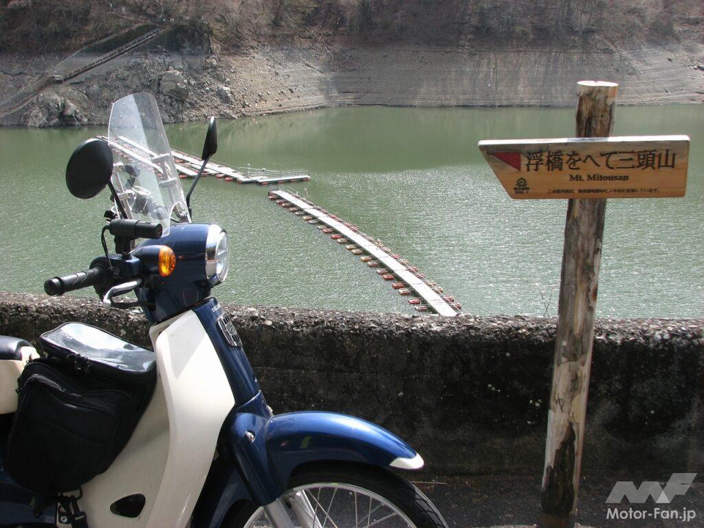
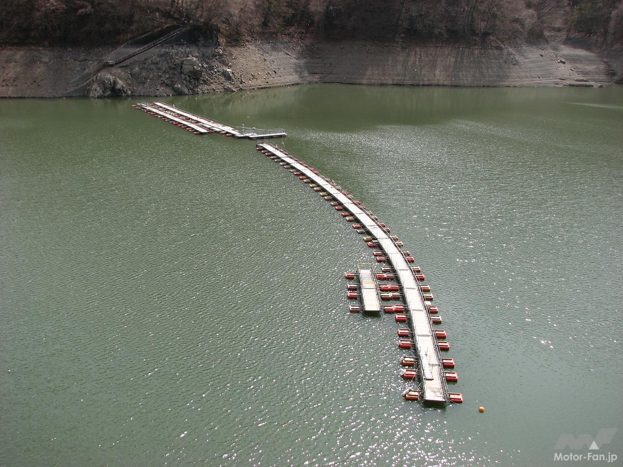
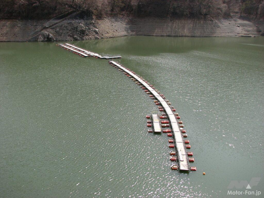
There are several floating bridges on Lake Okutama, and Mugiyama’s floating bridge is one of them.
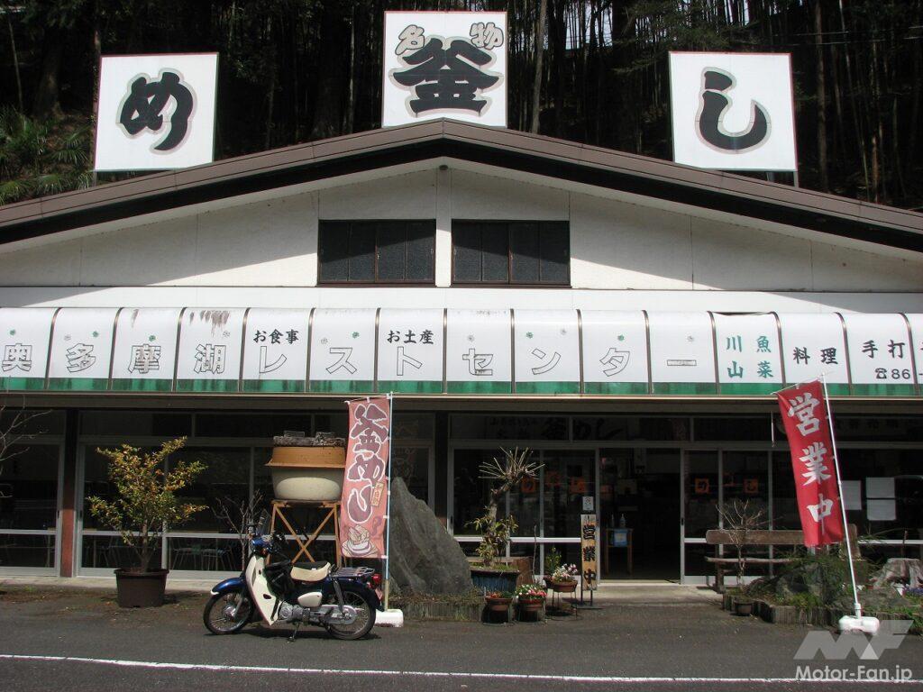
Okutama Lake Rest Center Maruitei is located along National Route 411. Its appearance is reminiscent of a Showa-era drive-in.
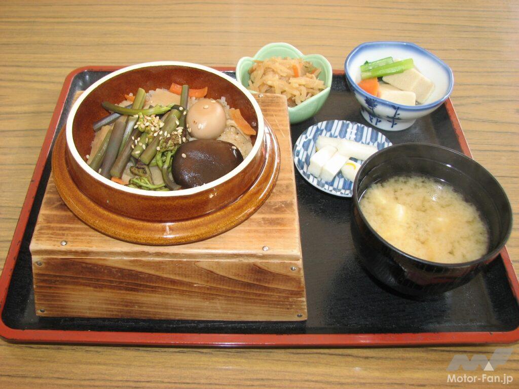
Maruitei’s specialty dish is wild vegetable rice pot. It comes with two small side dishes, pickles, and miso soup for 1,000 yen.
After enjoying the village of the sky and the bounty of the mountains on this leisurely Cub tour, I decided to continue on National Route 139 to Kosuge Village in Yamanashi Prefecture, then Prefectural Route 18 to Uenohara City, then Prefectural Route 522 to Fujino, before returning on National Route 20. The total distance traveled on this tour was 185 km, and I used about 3 liters of gasoline. Including the cost of meals, the trip cost about 1,500 yen.