![[Yama District, Fukushima Prefecture] A great touring spot for motorcycles | Be soothed by the mysterious and beautiful scene](https://motopeek.com/wp-content/uploads/2025/05/2712-1760843594008.jpg)
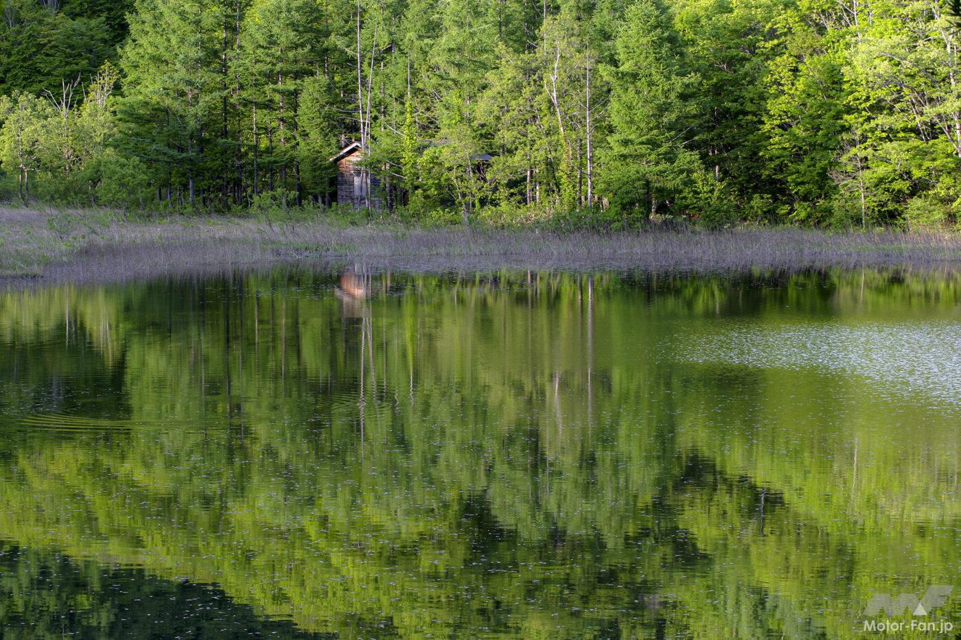
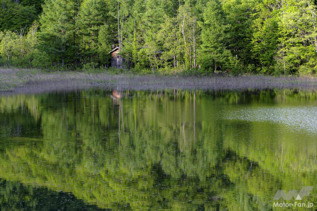
Lake Onogawa has beautiful reflections on its surface.
Mount Aizu Bandai is located north of Lake Inawashiro, Japan’s fourth largest lake, overlooking Mount Adatara to the east. It’s an active volcano with an elevation of 1,816 meters, and its southern base is called Omotebandai. This time, we’re looking at the “Urabandai Plateau” that stretches northward. Clear streams and waterfalls dot the numerous lakes and ponds. Its rich natural landscape changes color with the seasons, allowing visitors to enjoy its beauty throughout the year. The mystical, even fantastical, scenery deeply moves visitors.
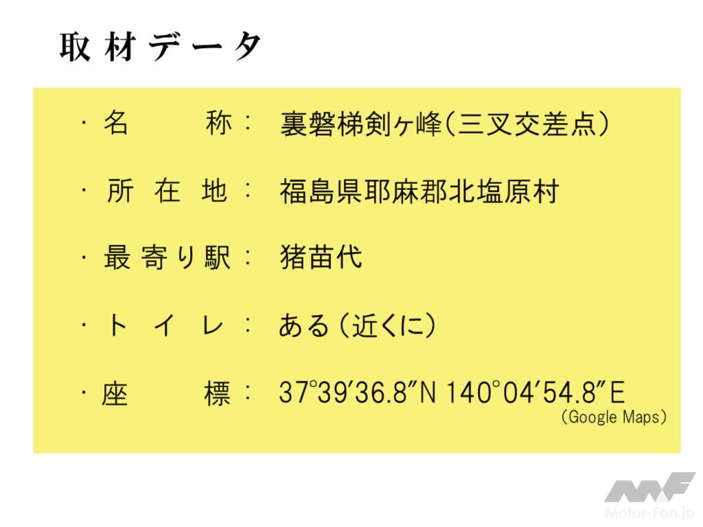
The coordinate point and address data for this article is the intersection of Urabandai Kengamine. Roughly speaking, this is the point where Prefectural Route 2, which runs south from Yonezawa City, intersects with National Route 459 (Yonezawa-Inawashiro Line), which runs east-west and connects Nihonmatsu City to Kitakata City and connects with National Route 115.
Prefectural Route 2 runs along the eastern shore of Lake Hibara, providing access to Nishi-Azuma Sky Valley. The Nakasenuma Observatory, where the photo below was taken, is about 3.2 km away and can be reached in about 7 minutes.
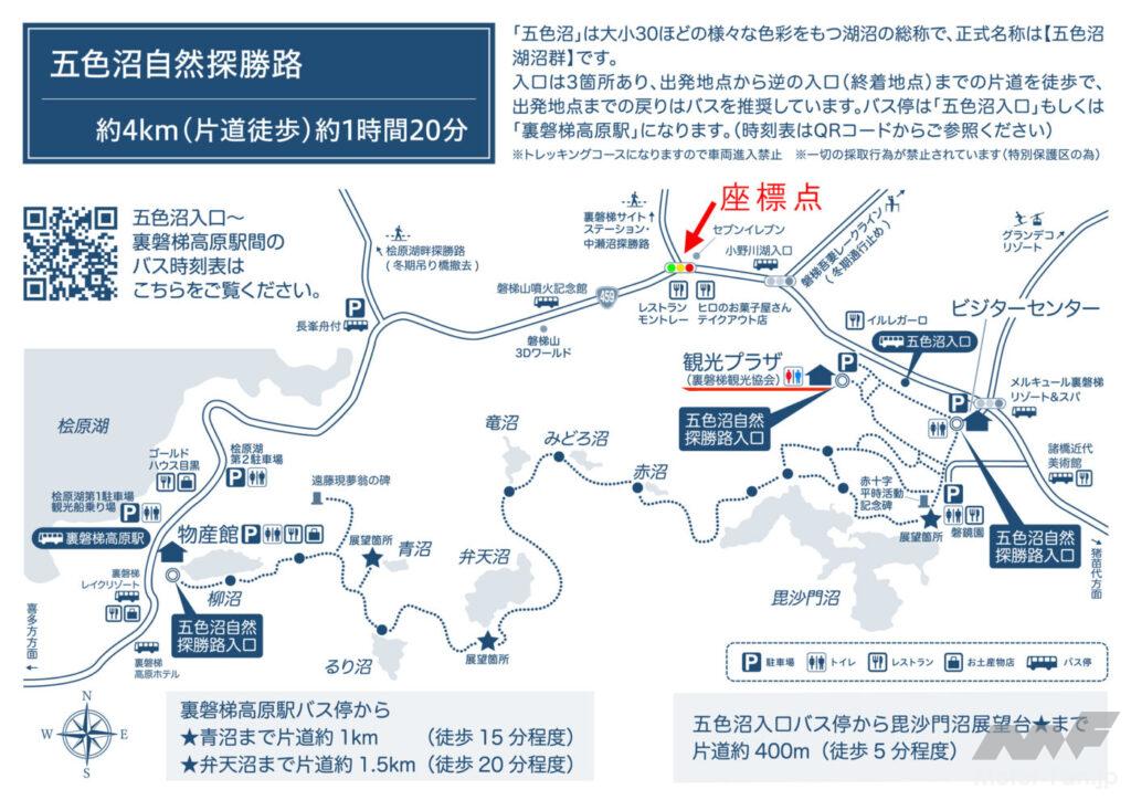
Because it’s a three-way intersection, there are no restrooms or other facilities nearby, but there are restaurants and convenience stores nearby. Travel about 750 meters east (about a 2-minute drive) along the national highway to the Goshikinuma Entrance Tourist Plaza, where you can use restrooms and rest areas, as well as gather tourist information and arrange accommodations. We recommend checking the website below in advance, and stopping by here (Goshikinuma Entrance Tourist Plaza) first to review and plan your tour. It
‘s also wonderful to park your motorcycle and enjoy trekking along the Goshikinuma Nature Trail. You can also take advantage of the mobility of a motorcycle to explore various viewpoints. The mystical landscape of the Goshikinuma Lakes stretches out to the south of the Urabandai-Kengamine Intersection, with Lake Akimoto to the east and Lake Hibara, Lake Onogawa, and Lake Sohara to the north. The easiest way to get there is to get off the Ban’etsu Expressway at the Inawashiro Bandai Kogen Interchange and head north on National Route 115 and Prefectural Route 2, which will take you to the coordinate point in about 21 minutes (16.5km).
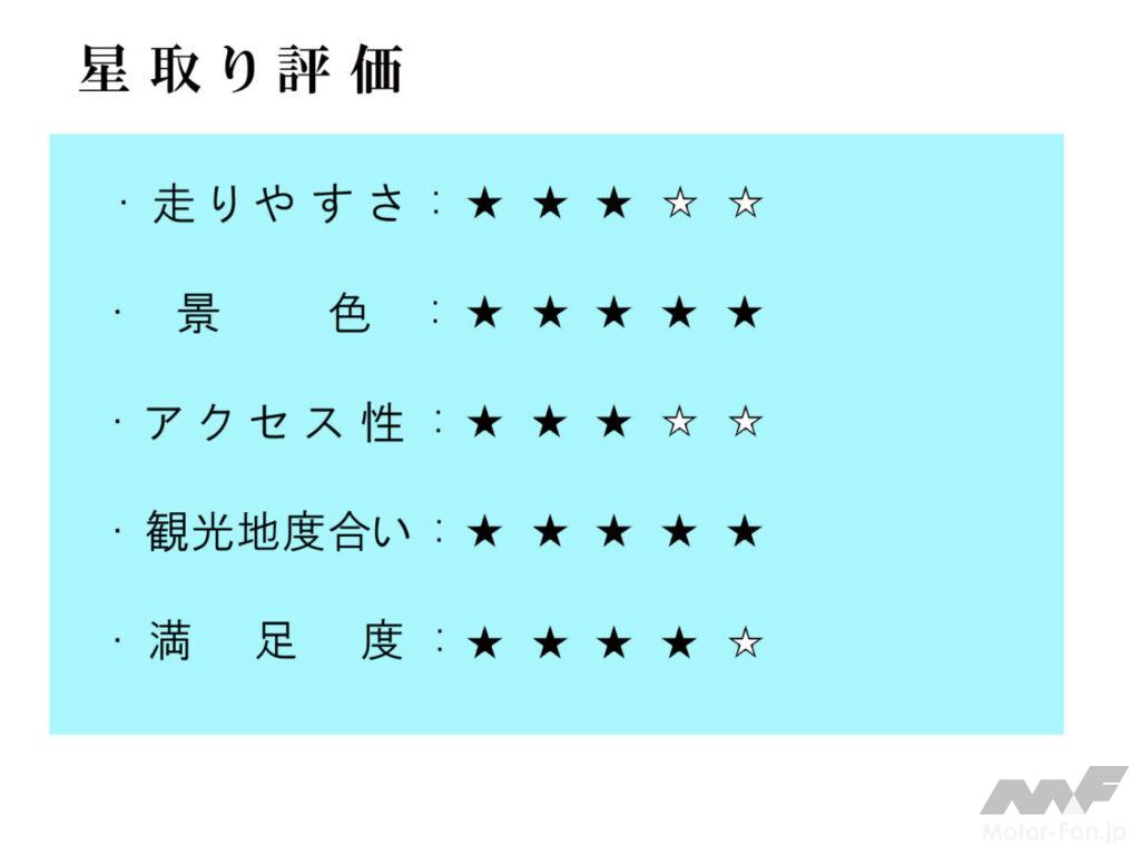
Some of the surrounding roads are narrow, so you’ll need to be careful of oncoming traffic, but there are also mountain passes that are great for motorcycle riding, and the Ura Bandai Kogen Plateau, surrounded by a rich natural environment, is the perfect touring course. There are also many hot spring inns in the area. What’s more, the beautiful scenery is soothing to the soul and is truly impressive.
You will be captivated by the beauty of each season.

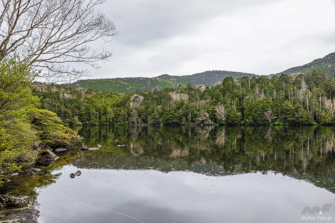
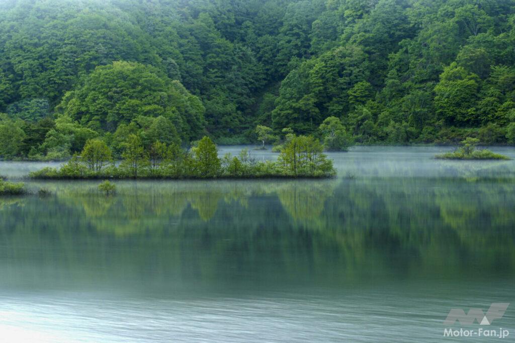
A panoramic view of the lush greenery from Nakasenuma Observatory.
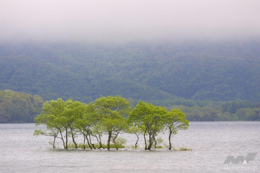
One of the iconic viewpoints of Lake Hibara.
The quiet and soothing atmosphere of Osawa Numa.
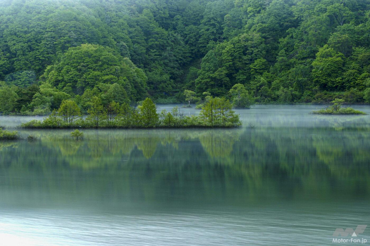
You will be greeted by a fantastic view of morning mist rising from the lake surface.
Morning view of Lake Hibara.

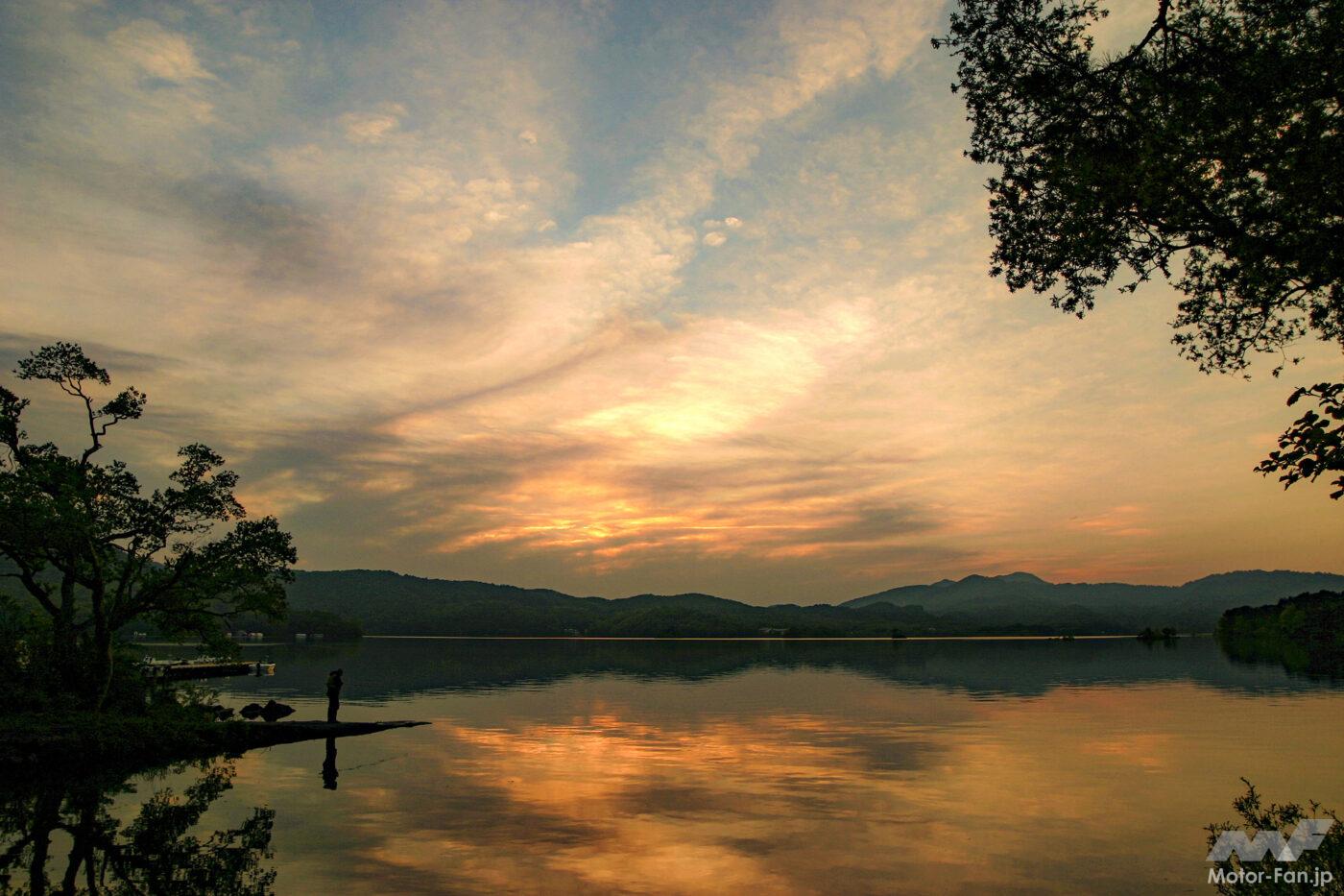
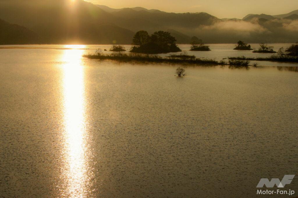
Evening view of Lake Hibara.
Urabandai Tourism Association website
URL: https://www.urabandai-inf.com
Hibara Kengamine, Kitashiobara Village, Yama District, Fukushima Prefecture (20 minutes by car/approximately 16km from Inawashiro Station on the JR Ban’etsu West Line)